

GIS PEACE Geospatial Consulting Services
Strategic Solutions for Government and Private Sector Teams
throughout the Rocky Mountain region.
Who We Are
GIS Peace is a geospatial consulting firm providing GIS consulting, mapping, spatial analysis, and community-focused solutions for government agencies, utilities, and organizations throughout Colorado and the Rocky Mountain region.
Led by founder and GIS Director Nicole Peace, our team brings decades of experience across environmental, engineering, and enterprise GIS environments.
We partner with organizations to understand how their data functions today, and how it should evolve moving forward, designing solutions that are both technically sound and practical to use.
Proudly certified as a Minority/Women-Owned Business Enterprise (MWBE) and Small Business Enterprise (SBE) by the City and County of Denver.

What We Do
Practical solutions designed to support real-world decisions.
Enterprise GIS
Scalable systems to organize, manage, and deliver geospatial data across organizations.
GIS Production
High-quality mapping and data visualization that transform complex information into clear, usable insights.
Implementation
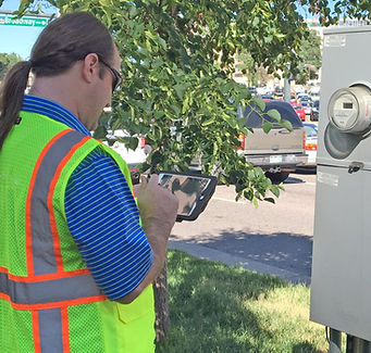
Custom applications and workflows that bring GIS into daily operations—both in the field and in the office.

Our Process
Every project follows a structured lifecycle designed to bring clarity,
reduce risk, and support long-term success.
1
Discover
Understand the problem,
stakeholders, and environment
2
Define
Translate needs into clear
requirements and strategy
3
Design
Architect systems, workflows,
and user experience
4
Build
Develop, configure, and implement
solutions that deliver results
5
Refine
Validate performance,
troubleshoot, and improve
6
Support
Launch with confidence and
provide ongoing support